Drawings

DSC_4244edited
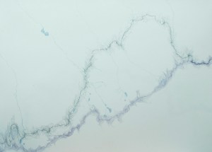
Here are some drawings about walking, water, and the Continental Divide. So far there are 30 of them and they cover my route for about 800 miles across Montana and the Idaho border.

Water Divided: Drawings

I’ll get the technical aspects of these drawings out of the way first. Using maps (put together by Jonathan Ley) that showed where the Continental Divide is and where my route ought to have gone, as well as my recollections of where I actually walked (I will admit that sometimes I had only a vague idea of where I actually was), I drew out where I walked (in graphite) and the designation of the Divide (in purple) with the topographic lines closest to each. Water sources that I drank from are shown in blue. The only water shown is what affected me or that I affected, so where the water came from and then where it went after I gathered it. All drawings are on 18×24 sheets of paper.

Walking for me is experiencing distance and time at the speed of slow thought, of daydreams. Moving through the landscape for months on end, often alone, gives abundant time for thinking and it’s a wonderful time for thinking about art. And various peculiarities of life. And connections. And the mundane but very important questions of where to camp (actually, where am I right now??), what I have available to snack on and… where is my water? When I thought about water and art at the same time I also had to think about topography; the land telling the water where to go and the water shaping the land. I knew that the data I was gathering had to be represented in a way that considered the water’s path, my path, and the shape of the land, as well as all the time and space available for thought and daydreams. In drawing it out I got to experience the landscape again at a human pace, only this time by pencil rather than on foot. Meaning and memories became encoded in the topographic lines, and I became aware of another sense of space while watching the water flow across the paper from and to places that I couldn’t see and didn’t know. Maps show land all at once, as though viewed from the sky- something impossible to see while standing on the ground. Traveling through on foot one gains an intimate knowledge of what is immediately around with a vast expanse of unknown spreading out in all directions.

There are other thoughts to have on water: how it connects us to the land and to each other, how to conserve it, thoughts of dangerous water, thoughts about weather patterns… I could think on and on about water, but I think I’ll stop here for now.

Thanks to Valentin Florescu for photographing these drawings for me.

Water, divided

SAM_4205SAM_4206SAM_4234SAM_4272SAM_4285
SAM_4336SAM_4432SAM_4457SAM_4539SAM_4545SAM_4561
SAM_4566SAM_4572SAM_4575SAM_4578SAM_4585SAM_4605
SAM_4622SAM_4652SAM_4653SAM_4723SAM_4759SAM_4770

Water, divided, a set on Flickr.

Here is a photo gallery of nearly all of the water sources that I drank from while walking the Continental Divide Trail. Not every source is represented because I chose to not photograph faucets while in town (it is not clear where the water comes from), because sometimes someone else brought me water, and because sometimes I forgot. Usually the photo is up close, but sometimes I took pictures from farther away so as to give a sense of the landscape that the water influences and inhabits.

Pie Town, NM to Mexican Border

11/8

2 ½ liters from Pie Town, NM.


11/9

3 liters from Pie Town, NM.


11/10

3 liters from Pie Town, NM.


11/11

2 ½ liters from Pie Town, NM.

11:45 am- ½ liter from a cache at Fur and Feathers animal shelter.

5:00pm- 4 liters from a well 17 miles south of Pie Town on Ed Jones Road. 

Note: After Pie Town I began walking with a group of hikers that I had met earlier in the trip (trail names Lush, Manparty, and the Captain).  We had occasional road support for a few days from H-Bomb, a visiting hiker.


11/12

12:00 pm- 1 liter from Valle Tio Vinces spring.  (Bleach)

5:15 pm- 3 liters from a well/cattle trough in Tularosa Canyon.  (Bleach)


11/13

1:30 pm- ½ liter Tularosa Canyon water from Captain.

6:00pm-  1 liter bottled water supplied by H-Bomb.


11/14

3 ½ liters bottled water.


11/15

1:00 pm- Thunderstorm.

4:50 pm- 1 liter from Gila River.  (Bleach)

6:00 pm- 2 liters from Gila River.  (Bleach)

Rain and thunderstorms throughout night.


11/16

2:15 pm- 1 liter from Gila River.  (Bleach)

8:00 pm- 1 liter bottled water from H-Bomb.


11/17

2 ½ liters bottled water.

8:30 pm- ½ liter from Little Toad Creek Inn at intersection of NM 15 and 35.

We had been following the Gila River, but were advised that the southern section after the Gila Cliff Dwellings was dangerous and impassible due to flood damage caused by unusual amounts of rain earlier in the year, so we elected to walk roads until we could meet up with the trail again.

11/18

2 liters of bottled water

8:00 pm- 2 liters from Mimbres Valley Fire Station.


11/19

11:30 am- 3 ½ liters from East Canyon.  (Bleach)

7:40 pm- 1 liter from spring north of the Divide and west of Hillsboro Peak.  (Bleach)


11/20

2:40 pm- 1 liter from piped spring.  (Bleach)

5:30 pm- 3 liters from Berrenda Creek.  Full of nasty algae.  (Strained through bandana, and bleach)


11/21

11:30 am- 1 liter from windmill driven well near Macho Road due east of Greg Hills.  (Bleach)  Captain informs me that I don’t ever seem to carry enough water.

9:00 pm- 3 liters from big tank southwest of Hyatt Ranch along old Butterfield Stagecoach route.  (Bleach)


11/22

12:00 pm on- 2 liters from Deming, NM.


11/23

2 ½ liters from Deming, NM.

Rain, sleet, and snow throughout day, snow overnight.


11/24

Snow in the morning.

3 liters from Deming, NM.


11/25

10:30 am- 2 liters from Willie Pritchard’s house, corner of Waterloo Road and NM 11.

2:30 pm- 1 liter from town of Columbus, NM.


11/26

10:00 am- 2 liters from Columbus, NM.

2:00 pm- Reached Mexican Border at Puerto Palomas.


Cuba, NM to Pie Town, NM

10/28

3 liters from Cuba, NM.

6:50 pm- 1 ½ liter from Jones Spring.  (Bleach)


10/29

1:15 pm- Spring with spigot at N 35.71096 W 107.08548 (aka cow trough in the middle of nowhere).  Obtained 1 liter, but then the spigot stopped working.  I was able to get another ½ liter from the questionable looking pool under the spigot.  The next water source is 15 miles away. (Bleach)

8:00 pm- Very nearly out of water.

9:00 pm- Light rain.


10/30

10:00 am- 2 liters from Ojo Frio.  (1 filter, 1 bleach)

3:00 pm- Intermittent snowstorms that continue through evening.

5:15 pm- 2 ½ liters from Ojo de los Indios.  (Bleach)


10/31

6:25 pm- 3 liters from American Canyon Spring.  (Bleach)


11/1

1:00 pm- 2 liters of bottled water from a cache placed by Carol and Hugo Mumm at Forest Road 193.

8:00 pm- ½ liter from town of Grants, NM.


11/2

2 liters bottled water, ½ liter city water from Grants.


11/3

2 ½ liters bottled water, ½ liter city water from Grants.


11/4

10:30 am- ½ liter of bottled water from people looking for firewood on Forest Road 447.

12:00 pm- 1 ½ liters bottled water from Mumms’ cache near Zuni-Acoma trailhead at Hwy 53.

5:00 pm- 2 ½ liters bottled water from Mumms’ cache near Zuni-Acoma trailhead at Hwy 117.

Thunderstorms during the night.


11/5

Thunderstorms in the morning, then sleet and rain.

1 ½ liters from Grants, NM.


11/6

2 liters from Grants, NM.


11/7

8:45 am- 1 liter from a nice man on the road.

9:15 am- 1 liter from a rancher.

12:30 pm- 1 ½ liters from Thomas Mountain Ranch.

7:00 pm- 1 liter from Pie Town, NM.

Chama, NM to Cuba, NM

10/18

2 liters from Chama, NM.

6:20 pm- 1 liter from small stream on Hwy 17 between mile markers 15 and 16.  (Bleach)

Note: At this point I have split off from the group I was hiking with due to differing opinions on pace and route.


10/19

I awoke to find that most of my water was undrinkable due to being frozen.

10:15 am- 1 liter from some hunters on Hwy 17.

4:45 pm- 2 liters from Dixie Creek.  (Bleach)


10/20

10:50 am- 1 liter from Rio Brazos.  (Bleach)

5:20 pm- 2 liters from Lagunitas Creek.  (Bleach)


10/21

10:30 am- 1 liter from Rio San Antonio.  (Bleach)

6:45 pm- 2 ½ liters from Hopewell Lake outlet.  (Bleach)


10/22

9:40 am- dumped out ½ liter of Hopewell Lake water, took 1 ½ liters from spring southeast of Rock Creek.  (Bleach)

5:00 pm- 2 ½ liters from piped spring northeast of Canoras Spring.  (Bleach)


10/23

12:00 pm- 3 liters from Harris Bear Spring.  (Bleach)

5:30 pm- ½ liter bottled water from hunters near junction of Forest Roads 137 and 139.


10/24

2 liters from Ghost Ranch.


10/25

3 liters from Ghost Ranch.

6:45 pm on- Rain and thunderstorms.


10/26

10:30 am- 2 liters from stream in Ojitos Canyon.  (Bleach)

6:20 pm- 2 ½ liters from Rio Capulin (in Cecelia Canyon).  (Bleach)


10/27

2:00 pm- 1 liter from Rio Puerco.  (Bleach)

7:00 pm- 1 liter from town of Cuba, NM.

Lake City, CO to Chama, NM

10/4

2 liters from Lake City, CO.


10/5

3 liters from Lake City, CO.


10/6

9:00 am- 2 liters from Lake City, CO.

4:30 pm- 3 liters from spring on south side of Divide.  (Bleach)


10/7

1:00 pm- 1 liter from stream feeding Lost Trail Creek.  (Bleach)

8:45 pm- 2 liters from small stream (remote source of Rio Grande) (Bleach)


10/8

12:10 pm- 1 liter from Quartzite Creek.  (Bleach)

3:40 pm- ½ liter from Nebo Creek.  (Bleach)

8:15 pm- 1 liter from snowmelt that eventually feeds Flint Creek.  (Bleach)


10/9

10:30 am- 1 liter from Rincon La Vaca Creek.  (Bleach)

4:30 pm- 1 liter from Squaw Creek.  (Bleach)

7:00pm- ½ liter from stream feeding Rio Grande.  (Bleach)

After receiving word of an approaching blizzard, we came down off the Divide at Weminuche Pass and began working our way toward Creede, CO.  Rained during the night.


10/10

Sleet and snow all day, lasting overnight.

2 liters from town of Creede, CO.


10/11

3 liters from Creede, CO.


10/12

8:00 am- 1 ½ liters from Creede, CO.

7:30 pm- 1 liter from South Fork, CO.


10/13

9:00 am- 1 liter from South Fork, CO.

3:30 pm on- 1 ½ liters from Pagosa Springs, CO.


10/14

3 liters from Pagosa Springs, CO.


10/15

2 liters from Pagosa Springs, CO.

8:00 pm- 1 liter from Park Creek.  (Filter)

2-5 inches of snow overnight.


10/16

9:50 am-1 liter from spring on Forest Road 380 around mile marker 10.  (Bleach)

Occasional light snow during the day.

2:00 pm- 1 liter from small stream near Elwood Pass.  (Bleach)

7:30 pm- 1 ½ liter from town of Platoro, CO.


10/17

3:40 pm- dumped out ½ liter of Platoro water, took 1 liter of well water from Rocky Mountain Lodge on Forest Road 250.

8:00 pm- ½ liter from town of Chama, NM.

Monarch Pass to Lake City, CO

9/28

2 liters from Salida, CO.


9/29

9:00 am- 1 ½ liters from store at Monarch Pass.

6:30 pm- 1 ½ liters from stream at Marshall Pass.  (Bleach)


9/30

7:40 am- 1 liter from stream at Marshall Pass.  (Bleach)

1:30 pm- 2 liters from Seven Tank Creek.  (Bleach)

9:00 pm- 1 ½ liters from Razor Creek.  (Bleach)


10/1

7:30 am- ½ liter from Razor Creek.  (Bleach)

11:00 am- 1 liter from Lajon Creek.  (Bleach)

3:40 pm- 1 liter from Archalela Creek.  (Bleach)

8:00 pm- 2 liters from Van Tassel Gulch.  (Bleach)


10/2

11:30 am- 1 liter from Cochetopa Creek.  (Bleach)

1:25 pm- 1 liter from Stewart Creek.  (Bleach)

5:00 pm- 1 liter from Cochetopa Creek.  (Bleach)

8:00 pm- 1 liter from snowmelt off San Luis Peak.  (Bleach)


10/3

10:00 am- 1 liter from small stream.  (Bleach)

1:30 pm- 1 liter from a spring feeding East Mineral Creek.  (Bleach)

8:00 pm- 1 liter from Lake City, CO.

Leadville, CO to Monarch Pass, CO

9/21

12:00 pm- 1 ½ liters from Leadville, CO.

7:30 pm- 1 ½ liters from small stream in Longs Gulch.  (Bleach)


9/22

Rain on and off all day, thunderstorms in afternoon.

9:00 am- 1 liter from stream on southeast side of Galena Mtn.  (Bleach)

12:15 pm- 1 liter from stream on northeast side of Bald Eagle Mtn.  (Bleach)

4:00 pm- 1 liter from Willow Creek.  (Bleach)

6:40 pm- 1 liter from Mill Creek.  (Bleach)

Rain turns to snow overnight.


9/23

9:00 am- 1 ¼ liter from Bartlett Creek.  (Bleach)

3:00 pm- ½ liter from town of Twin Lakes, CO. 

5:00 pm- 1 liter from Mt. Elbert Lodge.


9/24

7:00 am- 1 liter from Mt. Elbert Lodge.

11:00 am- 1 liter from Little Willis Creek.  (Bleach)

4:00 pm- 1 liter from stream feeding Clear Creek.  (Bleach)

8:00 pm- 2 liters from Lake Ann.  (Bleach)


9/25

12:15 pm- 1 liter from stream on south side of Lake Ann Pass.  (Bleach)

3:45 pm- 1 liter from small stream feeding Texas Creek.  (Bleach)

7:30 pm- 2 liters from Sanford Creek.  (Bleach)


9/26

12:45 pm- 1 liter from East Willow Creek.  (Bleach)

4:30 pm- 1 liter from stream on east side of the Divide.  (Bleach)

7:00 pm- 1 liter from Chalk Creek.  (Bleach)

Rain and snow overnight.


9/27

Snow.

9:00 am- 1 liter from stream feeding Chalk Creek.

4:00 pm- ½ liter from store at Monarch Pass.

5:00 pm- 1 liter from town of Salida, CO.  (No snow here)

Grand Lake, CO to Leadville, CO

9/12

4 liters from Grand Lake, CO.


9/13

8:30 am- 1 liter from Grand Lake, CO.

1:30 pm- 1 liter from Mill Creek.  (Bleach)

7:45 pm- 2 liters from Cabin Creek.  (Bleach)


9/14

7:15 am- 2 liters from Cabin Creek.  (Bleach)

9:50 am- 1 liter from spring on west side of the Divide.  (Bleach)

1:30 pm- Thunderstorms force us to detour off of the Divide.  Rain and  thunderstorms continue for the rest of the day and night.


9/15

11:00 am- 2:00 pm- Rain.

2:00pm on- 2 liters from town of Winter Park, CO.


9/16

11:00 am- 1 liter from Winter Park, CO.

6:30 pm- 2 liters from Vasquez Creek.  (Bleach)


9/17

12:00 pm- 1 liter from Bobtail Creek.  (Bleach)

1:00 pm- 1 liter from Bobtail Creek.  (Bleach)

7:00 pm- 1 liter from small stream on south side of Ptarmigan Pass.  (Bleach)


9/18

4:45 am- 6:30 am-  intermittent rain.

9:00 am- 1 liter from small stream south of Ptarmigan Peak.  (Bleach)

11:00 am on- 3 liters from town of Silverthorne, CO.

Rain starting at 4:00 pm and continuing through evening.


9/19

1 ¼ liters from Silverthorne, CO.

4:00 pm- 1 liter from Copper Mountain ski resort.

7:45 pm- 2 liters from Gully Creek.  (Bleach)


9/20

10:00 am- 1 liter from stream on east side of Elk Mtn.  (Bleach)

12:35 pm- 1 liter from Cataract Creek.  (Bleach)

4:00 pm on- 1 ½ liters from town of Leadville, CO.

Steamboat Springs, CO to Grand Lake, CO

9/7

3 ½ liters from Steamboat Springs, CO. 

Evening rain.


9/8

8:00 am- 1 ½ liters from Steamboat Springs, CO.

8:00 pm- 3 liters from Middle Fork Arapaho Creek.  (Bleach)

Rain all night.


9/9

Raining occasionally throughout the day.

8:10 am- 1 liter from Middle Fork Arapaho Creek.  (Bleach)

1:55 pm- 1 liter from a stream on the west side of Haystack Mtn.  (Bleach)

8:30 pm- 1 ½ liters from stream at Willow Creek Pass.  (Bleach)


9/10

Rain in the morning.

11:00 am- 2 ½ liters from stream feeding Trout Creek.  (Bleach)

9/11

9:00 am- 1 liter from North Supply Creek.  (Bleach)

12:20 pm- 1 liter from Rocky Mountain National Park Visitor Center.  Light rain.

1:30 pm on- 1 ½ liters from town of Grand Lake, CO. 

Rain overnight.